Local Sedona travel guide
Devil's Bridge Trail Guide: Routes, Parking, Crowds & Safety
A practical Devil's Bridge trail guide covering route choices, shuttle and parking strategy, the final climb, crowds, photo etiquette, and weather safety.
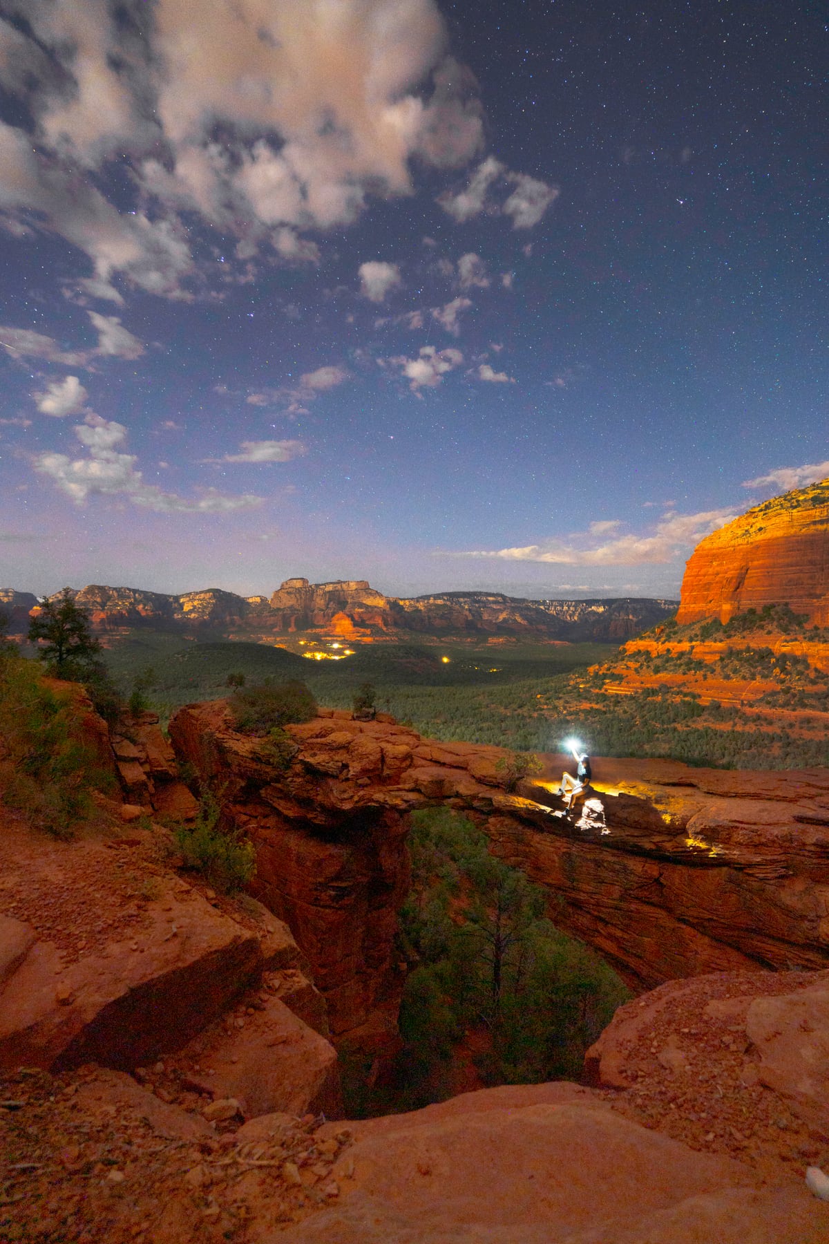
Devil's Bridge is the most famous photo hike in Sedona—and one of the easiest places to lose an hour to the wrong parking plan.
The bridge itself is worth seeing. The route is beautiful, the sandstone span is larger than it looks in photographs, and the final view opens across the forest. The experience is also crowded, exposed, and more complicated than “follow the trail to the arch.”
Here is how I would plan it.
Last checked September 13, 2026. Road access, shuttle service, closures, and weather change. Check the Sedona Shuttle and Coconino National Forest alerts immediately before your hike.
Devil's Bridge quick facts
Difficulty: Moderate for many hikers, with a steep rocky section near the end.
Trail type: Out and back from several possible starting points.
Best time: Early morning on a weekday.
Shade: Limited on the approaches.
Restrooms: Available at some lower parking or shuttle areas, not at the bridge.
Main challenges: Access, heat, crowds, the final climb, and exposure on the span.
People who are uncomfortable with heights can still enjoy the hike and surrounding viewpoints without walking onto the center of the bridge.
Choose your starting point before you leave
There is not one universal Devil's Bridge mileage because there are several approaches.
Mescal trailhead approach
This is a common route when trailhead shuttle service is operating. It connects Mescal and Chuckwagon trails to the Devil's Bridge Trail and gives you more trail scenery than walking the road.
Dry Creek Vista approach
From the paved lower area, hikers can follow the road or use the Chuckwagon connection. The road option is straightforward but exposed and shared with vehicles once beyond the gate or access point.
Upper Devil's Bridge trailhead
The upper trailhead is reached by an unpaved forest road and is not a normal passenger-car shortcut. Road condition, vehicle capability, weather, and current restrictions all matter. If you are uncertain, use the paved access and accept the longer hike.
Choose the route using a current official map. Download it before leaving town because service is not a navigation plan.
Parking and shuttle strategy
On operating days, the free trailhead shuttle can remove the need to fight for a small parking area. It does not remove the need to understand the route.
Confirm:
Which park-and-ride lot serves your approach.
The first and last scheduled pickups.
How long the connecting hike will take your group.
Whether parking is allowed at your intended lot on that day.
What you will do if the trail is closed or weather changes.
If you drive, park only in a legal space. Do not block neighborhood roads, gates, bike lanes, or emergency access because the hike is on your list.
What the trail feels like
The approach is mostly gradual, with open desert and red-rock views. On warm days, the lack of shade is more significant than the grade.
The final section climbs stone steps and uneven rock. It is not technical climbing, but you may use your hands for balance. Congestion makes the climb slower because people are moving in both directions.
Near the top, the bridge appears quickly. The sandstone span is broad enough to walk across, but the drop is real and there are no railings.
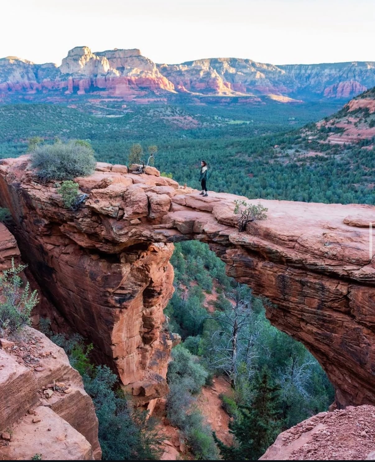
You do not need a complicated pose to make the photograph. One quick turn on the bridge keeps the line moving and lets everyone enjoy the place.
The best time to hike Devil's Bridge
Start early. Sunrise or shortly after gives you cooler temperatures, softer light, and the best chance of a shorter line.
Weekdays are generally calmer than weekends, but a beautiful weekday during spring break can still be busy. Late morning and midday combine more people with stronger sun.
Sunset can be beautiful, but it adds a dark return and can leave hikers clustered at the bridge waiting for the same light. Bring a headlamp and know the route before choosing it.
How to get the photo without taking over the bridge
Have the camera ready before it is your turn.
Take a few photographs, then step aside.
Keep the group small on the span.
Skip outfit changes and long productions when people are waiting.
Do not pressure anyone to walk farther than they want.
Never back toward an edge while watching a screen.
The bridge is public land, not a private portrait reservation.
Weather and safety
Do not underestimate summer heat. The exposed return can feel much hotter than the cool start.
During monsoon season, leave exposed terrain if thunder is nearby. Rain can make rock slick, and washes can change quickly. In winter, shaded sections may hold ice.
Wind matters on the bridge. If conditions do not feel right, enjoy the view from solid ground.
Carry water, sun protection, grippy shoes, a map, snacks, and a headlamp for any early or late plan. Tell someone where you are going.
Is Devil's Bridge a wedding photo location?
It is a public hiking destination with heavy traffic, a line, and no privacy. It is not where I would plan a ceremony or a large production.
Designated Wilderness has additional restrictions. Confirm the exact location and planned wedding coverage with the land manager before booking. See the elopement planning guide for next steps.
For a legal, realistic plan, read my Sedona elopement permits and logistics guide.
Alternatives if the experience does not fit
If the parking is full, the weather is wrong, or someone in the group dislikes exposure, do not force it.
Choose a lower trail with broad views, a scenic overlook, Doe Mountain, Brins Mesa, or a guided experience that matches your ability. The best hikes in Sedona guide gives you options by effort.
Devil's Bridge FAQ
How hard is Devil's Bridge?
Most prepared hikers describe it as moderate. The final rock steps, exposure, heat, and crowds are harder than the gradual approach.
How long is the hike?
It depends on the starting point. Expect a shorter route only if you legally reach the upper trailhead in an appropriate vehicle. Paved and shuttle-served approaches add distance. Confirm your exact route on a current map.
Is the bridge narrow?
It often looks thinner in photographs than it feels in person, but it is an exposed natural sandstone span with a serious drop. There are no railings.
Can you fly a drone at Devil's Bridge?
Do not assume you can. Airspace, launch-and-landing location, designated Wilderness, temporary restrictions, fire conditions, and commercial-use rules can all apply. Leave it home unless you have verified the entire flight is legal and responsible.